Pindus trail 2025 🥾⛺🏞️🐻
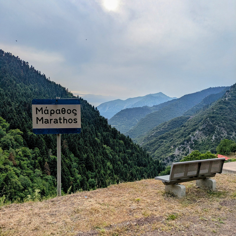
Table of Contents
01. Intro and plan
02. Karpenisi
03. Viniani
04. Kerasochori
05. Marathos
07. Return
Introduction
The Pindus Trail is a project by the Terra Pindus Cooperative, aiming to revive and connect old hiking paths across the Pindus mountain range into a single, epic 600 km trail. I first heard about it during a mountaineering course I took in 2024, and ever since, I've wanted to hike all or part of it. Finally, at the start of summer 2025, I decided to give it a go and hike a section of the trail.
Originally, my plan was to cover 180 km, starting from Karpenisi and ending in the small village of Moschofito near Trikala. I aimed to do this in about 10 hiking days, with a few rest days sprinkled in. I packed light—a small backpack with just an undermat and sleeping bag, no tent. I planned to eat at local restaurants and sleep outside or in public buildings like schools and chapels.
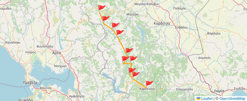
Well, things didn't go exactly as planned—bad weather and stomach issues got in the way. But, I did manage to cover the first 40 km, and it was absolutely amazing! In this post, I'll share some stories from that trip.
Karpenisi
I left Thessaloniki and took a train to Lamia. After two hitchhikes, I finally reached Karpenisi around 3 PM. The weather was already turning sour, with a light drizzle falling over the small town. I grabbed a bite, had a coffee, and set off on my first hike. The goal was to reach a chapel a few kilometers north of Karpenisi, check if it was suitable for sleeping, and if time allowed, push on to St. Kosmas, another little church about an hour further north.
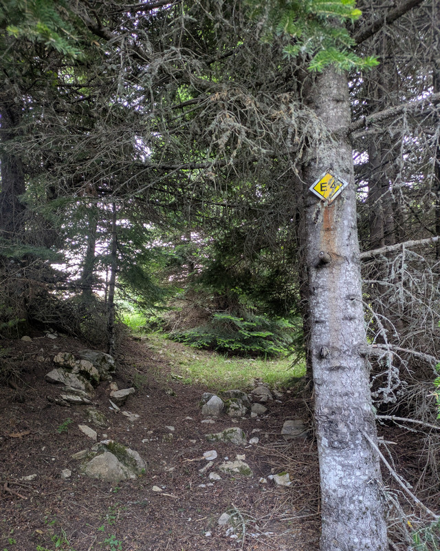
Right after starting, I realized I'd forgotten my hat in the last car I hitchhiked with. The sun was blazing—it was midday after all—but the sparse clouds and forest shade made the hike somewhat bearable. The route was beautiful and pretty easy, except for the sparse signage, which meant I had to check my phone's GPS regularly. The last half hour was especially nerve-wracking as thick clouds rolled in and distant thunder rumbled all around. When the drizzle started again, I had to pick up the pace and reach the chapel before the rain really hit.
Luckily, I made it just in time. The chapel seemed okay for an overnight stay, though there was no water source like I'd hoped. I rested a bit waiting out the rain. Later, I headed towards St. Kosmas since I had enough daylight. I followed the E4 trail for a while, stopped at a trough to wash up and rest, and even played my recorder for a bit before continuing carefree. What I didn't realize? I'd taken the wrong path and ended up circling back to where I started! 🤦
At that point, I decided to turn back to the first chapel since it was getting late and rain was forecast. I returned, set up my bed, and read until dark. Sleep wasn't exactly peaceful—jackals and other nocturnal critters howled and made noises all around the chapel.
Viniani
The next morning, I started hiking again. I had little water left from the previous day, so I had to ration carefully. My phone battery was below 40% when I set off. Eventually, I reached the next church, where there was plenty of water. I drank and refilled my bottles. Then I walked along a road for a few kilometers before rejoining the E4 trail. I had about an hour left to reach the Megdovas riverbed, which meant hiking under the scorching midday sun. Without my hat, I got a mild sunstroke.
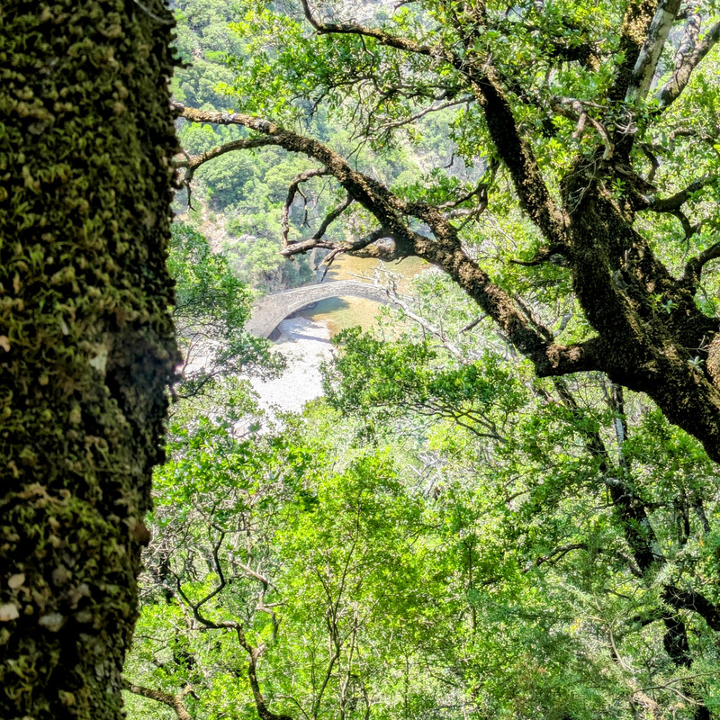
I stopped by the river to rest and cool off under an amazing old arched bridge. It was 2 PM when I decided to keep going, but my water and food were running low, and my phone battery was down to about 10%. That was the last straw—I was exhausted and desperate to reach the village. An hour later, I arrived in Viniani with 4% battery and plopped down at the first taverna I saw (one of only two in the village).
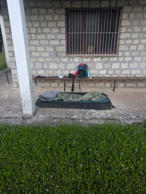
There, I met Tasia, the sweet old lady running the place. We chatted about village life, and she kindly pointed out a spot where I could sleep that night. I hung around the village and ended up sleeping in the schoolyard, just like Tasia suggested. Bonus: I saw fireflies again after many years!
Kerasochori
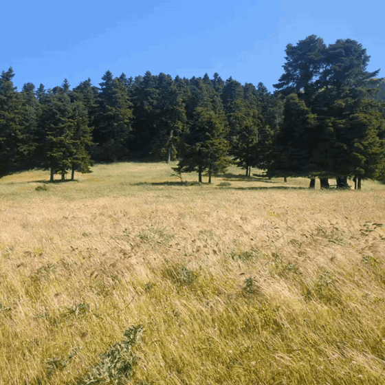
The next leg was a hike on the E4 from Viniani to Kerasochori. After a good night's sleep, I was in high spirits. This section had decent signage and was easy to follow. The forest was alive with dozens of flower and bird species, making the hike colorful and musical. However, the path was overgrown and abandoned in places, so I averaged about 1.5km/h, pushing through prickly bushes and branches. I decided to skip part of the E4 and take the road for a while.
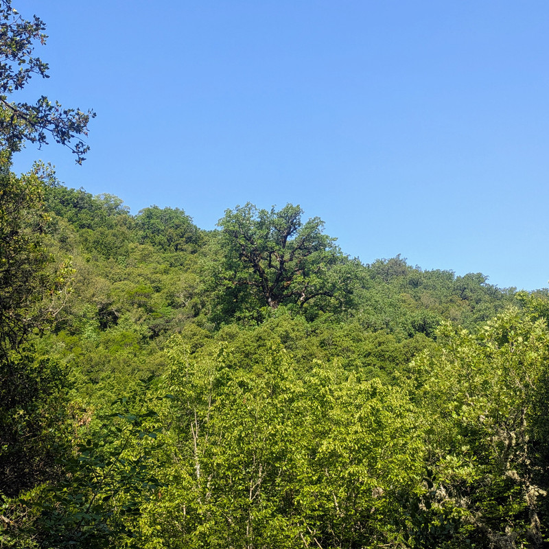
Further uphill, I rejoined forest roads and continued on the E4 until I reached Kerasochori. The village sits at about 1,000 meters altitude, so the last few kilometers saw oaks and chestnuts give way to fir forests. I immediately headed to the village's only food spot—a coffee shop.
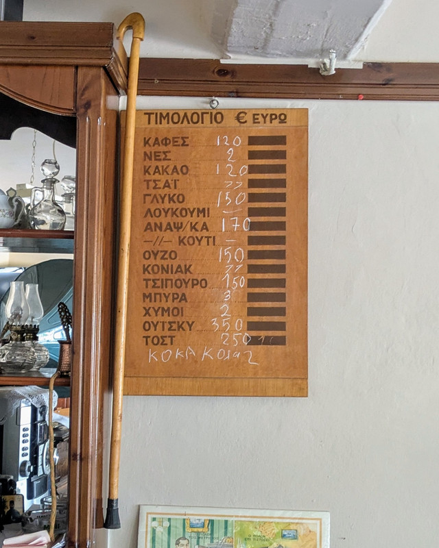
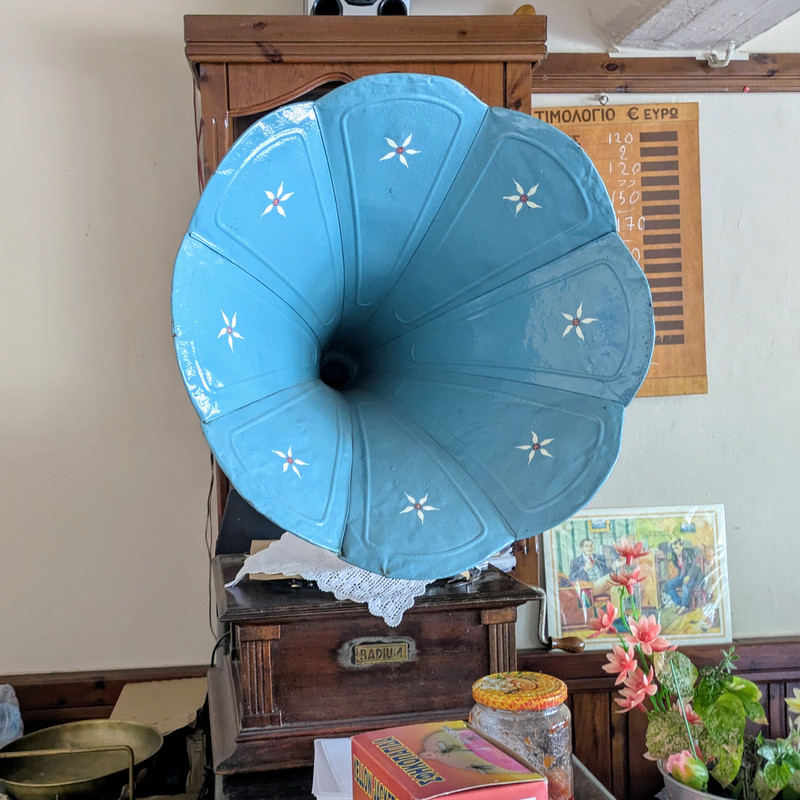
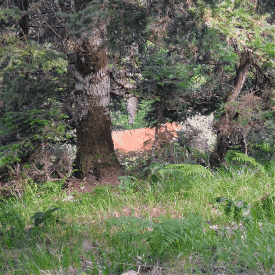
I spent most of the day between the coffee shop and the village kafenio, eating and drinking. Kerasochori is a beautiful place filled with stunning views and friendly people. Every little alley and square looked like a postcard. Locals kept buying me rounds and stopping by to ask about my journey. I initially tried to camp in the village middle school, but after hearing a wild boar nearby and feeling the place wasn't cozy, I moved to a small chapel instead.
At night, I went out for another drink and socialized with locals. Talking with them made me anxious about the next days' plan: reach Marathos and then hike to Monastiraki. I learned Marathos is semi-abandoned, with only seven residents, and its single store (a mini-market/kafenio combo) might be closed. Monastiraki wasn't much better. Given my phone battery issues and the general lack of water, I worried the plan might be too ambitious. Still, I decided to give it a shot and promised myself to turn back if things got too tough.
Marathos
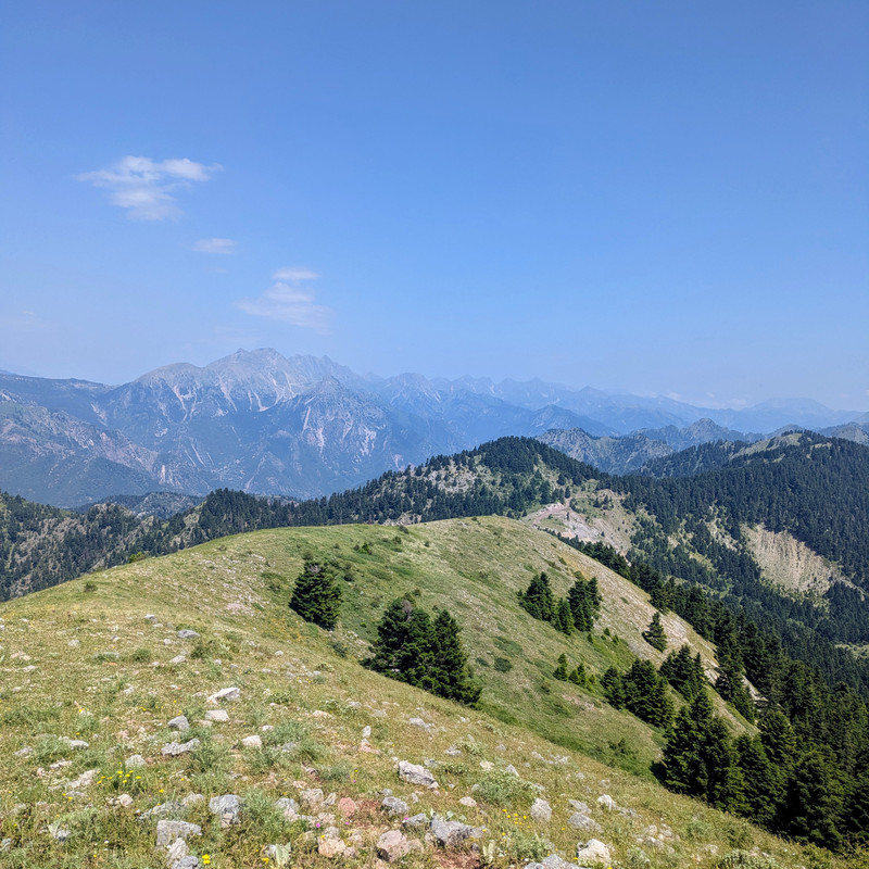
I woke early and headed to the coffee shop for a quick breakfast and to charge my phone. Then I started ascending the ridge above Kerasochori toward the first summit, Kafki, at 1,760 meters—the highest point of the day. The hike was mostly through fir woods, with a few hidden grassy meadows. The path had good signage and was mostly walkable until the alpine plains. After that, the summit came into view, but the signage disappeared. The way was obvious, though - straight up to the peak, then a big traverse across two more peaks to reach Marathos.
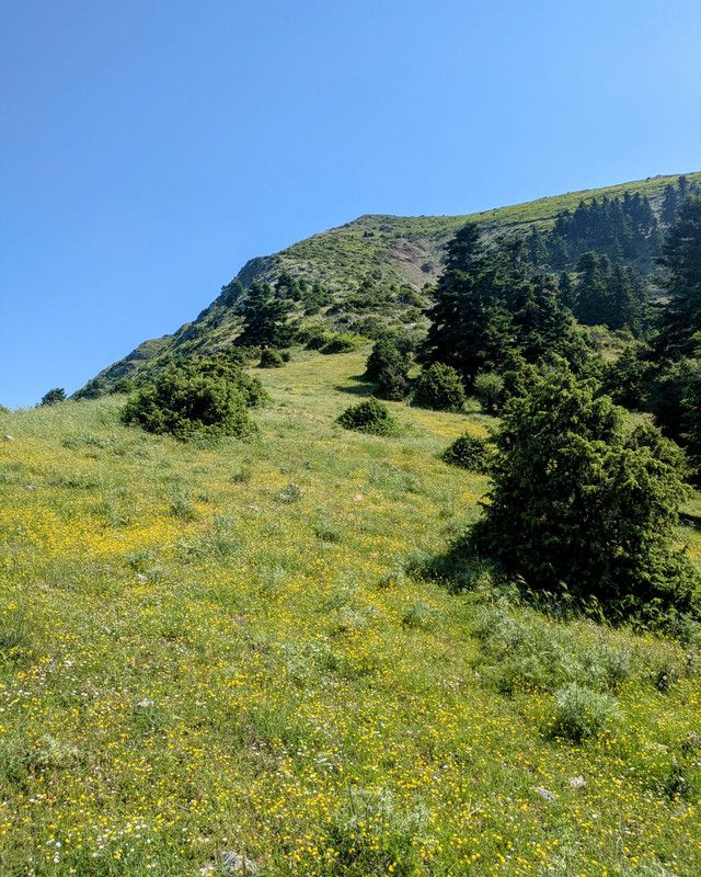
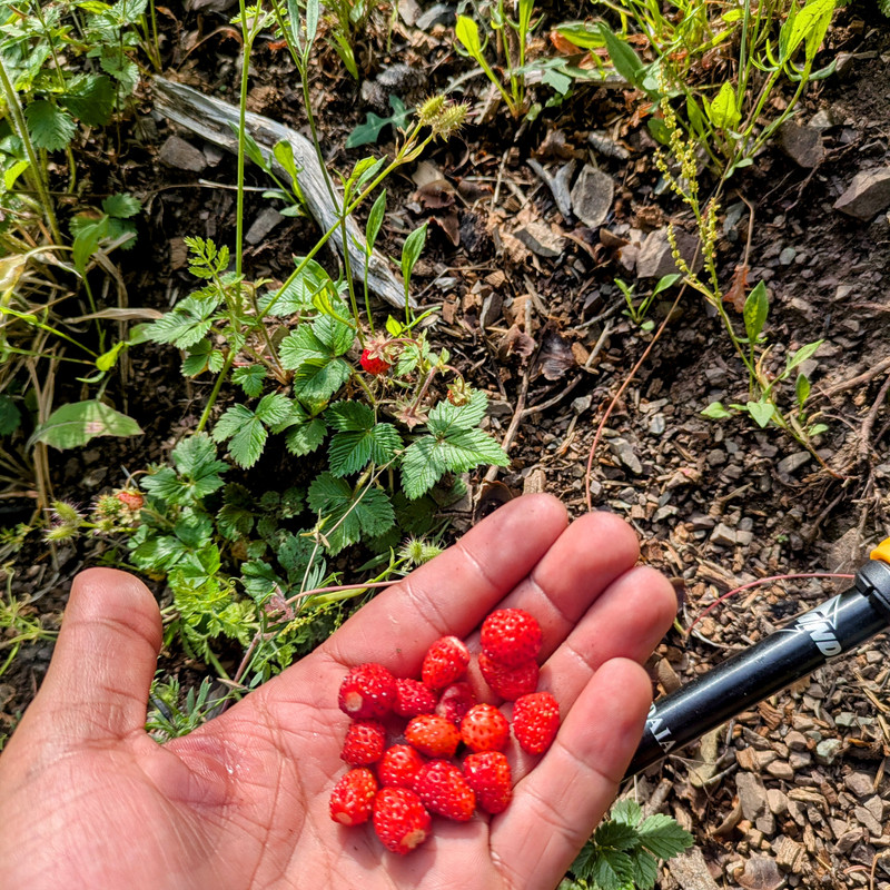
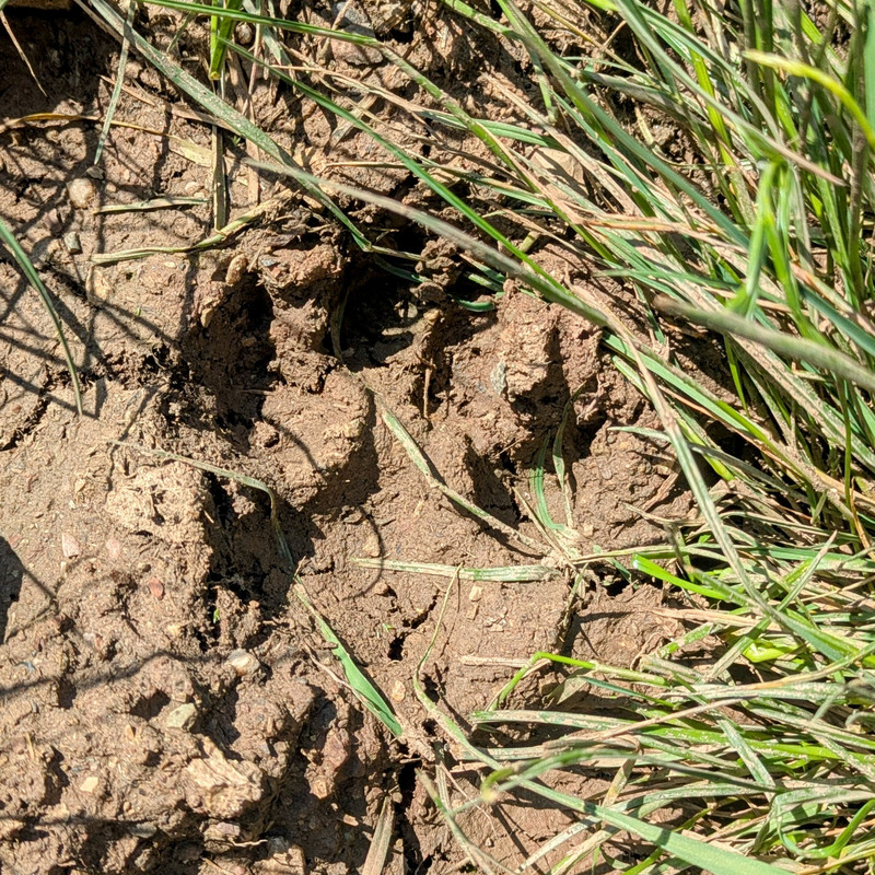
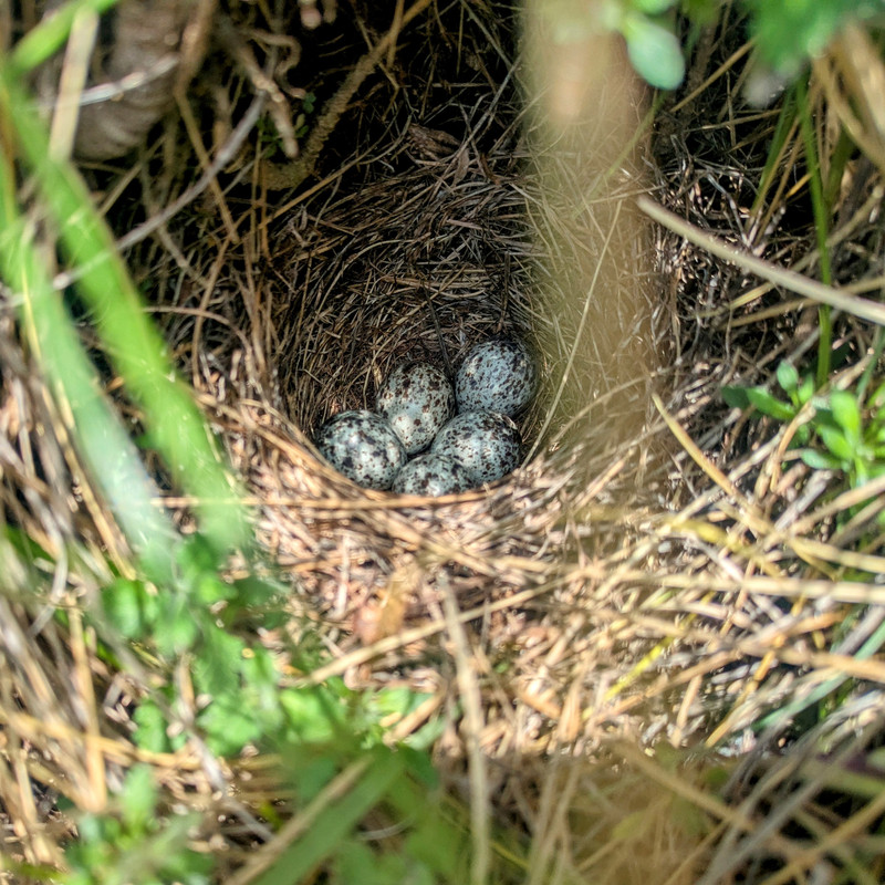
The wind was strong, but the weather was pleasant. I was rocking a new hat I bought in Kerasochori, which made a huge difference. The traverse across Vatoskala and Ouranos peaks was mostly alpine plains, with some fir woods and fern meadows on the saddles. It was tiring but majestic. I kept spotting bear footprints, which was a bit nerve-wracking, but also bird nests, wild strawberries, and breathtaking views!
Around two-thirds of the way to Marathos, I took a long break. After almost six hours of hiking, I was feeling it. I grabbed a bite and played my recorder for a bit—then packed up and realized I'd left the recorder behind! 🤦♂️
The last 3 km were all downhill through thick fir woods and ferns. Fallen trees blocked the path, forcing detours. The steep slope was tough on my knees—especially since I'd had PCL surgery six months earlier. I'd been rationing water all day, but was running dangerously low and had to resist chugging what little I had left. Bear footprints and boar rootings (where boars dig up soil) kept appearing everywhere. After eight hours of hiking, I hit an old forest road with 1.5km left. Exhausted, I seriously doubted I could make it.
I pushed through ferns taller than me and steep cliffs until I finally caught my first glimpse of Marathos. The final part involved crawling down a scarp—torturous, but I made it to the village square!
Nikos and Kostas, two locals, were waiting for me. Word of my arrival had spread from Kerasochori! Nikos is the village president (like a mayor for small communities). I hung out with them and a few others for the rest of the day. Nikos arranged a cozy room for me in a municipal building and helped plan my ride back to Kerasochori the next morning. I decided not to push further—my knee was hurting, and rain was forecast for the next few days.
Return
After Nikos kindly gave me a ride back to Kerasochori, I spent the day just chilling and recovering from my last hike. I looked into alternative routes I could try, but the weather was lousy all across Pindus, most of the nearby villages were either abandoned or lacked any place to grab food, and local bus services were basically non-existent. So, in the end, I decided to head back to Thessaloniki.
Those few days were both refreshing and challenging. The hikes were fantastic—if a bit tiring and definitely a bit unprepared on my part. The forest, especially the fir woods, was alive and generous. I'm definitely itching to revisit the trail and cover more of it. Next time, though, I'll probably stick to the sections that are cleaned up and well-marked. Also, it would be way easier on the psyche if I wasn't hiking solo, so I'll be on the lookout for some company next time around.